
 Polski
 Deutsch
 Slovenský
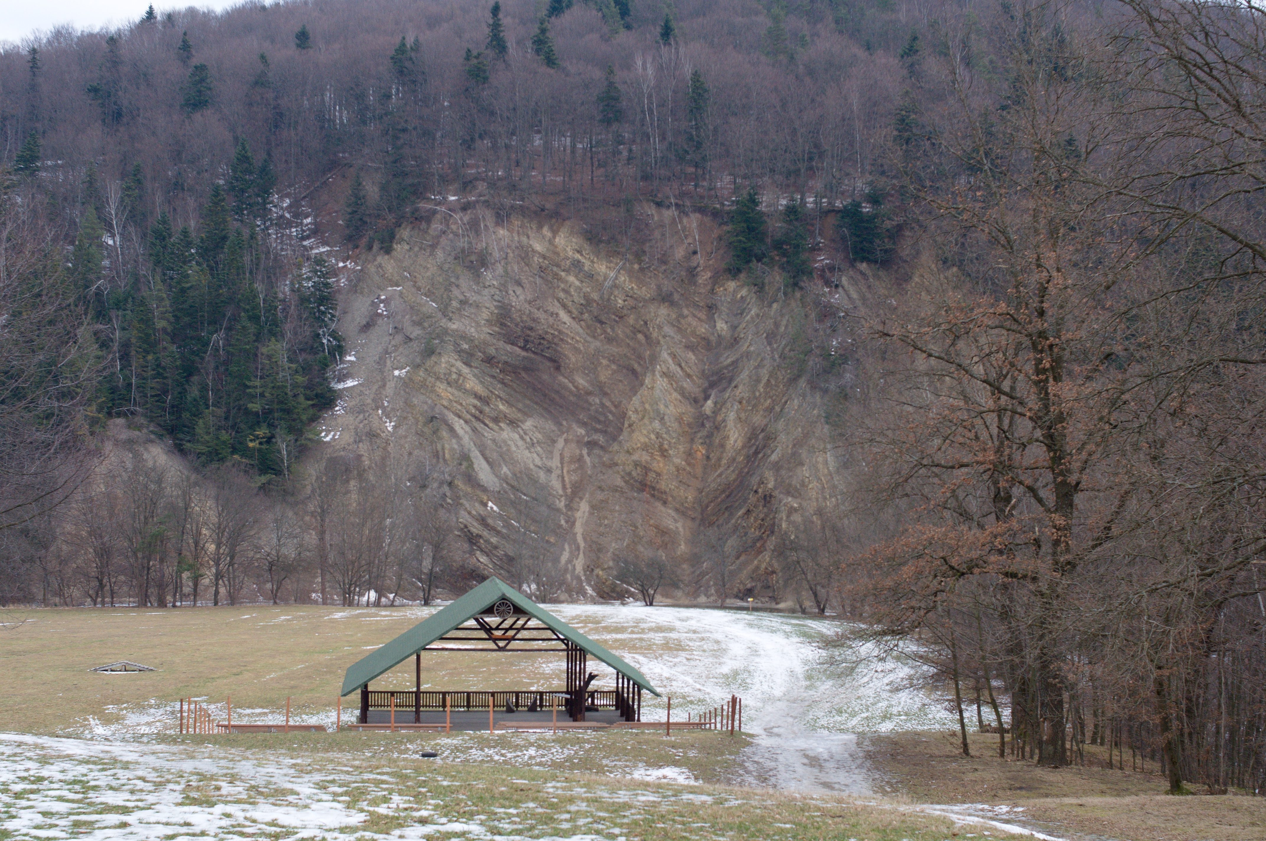
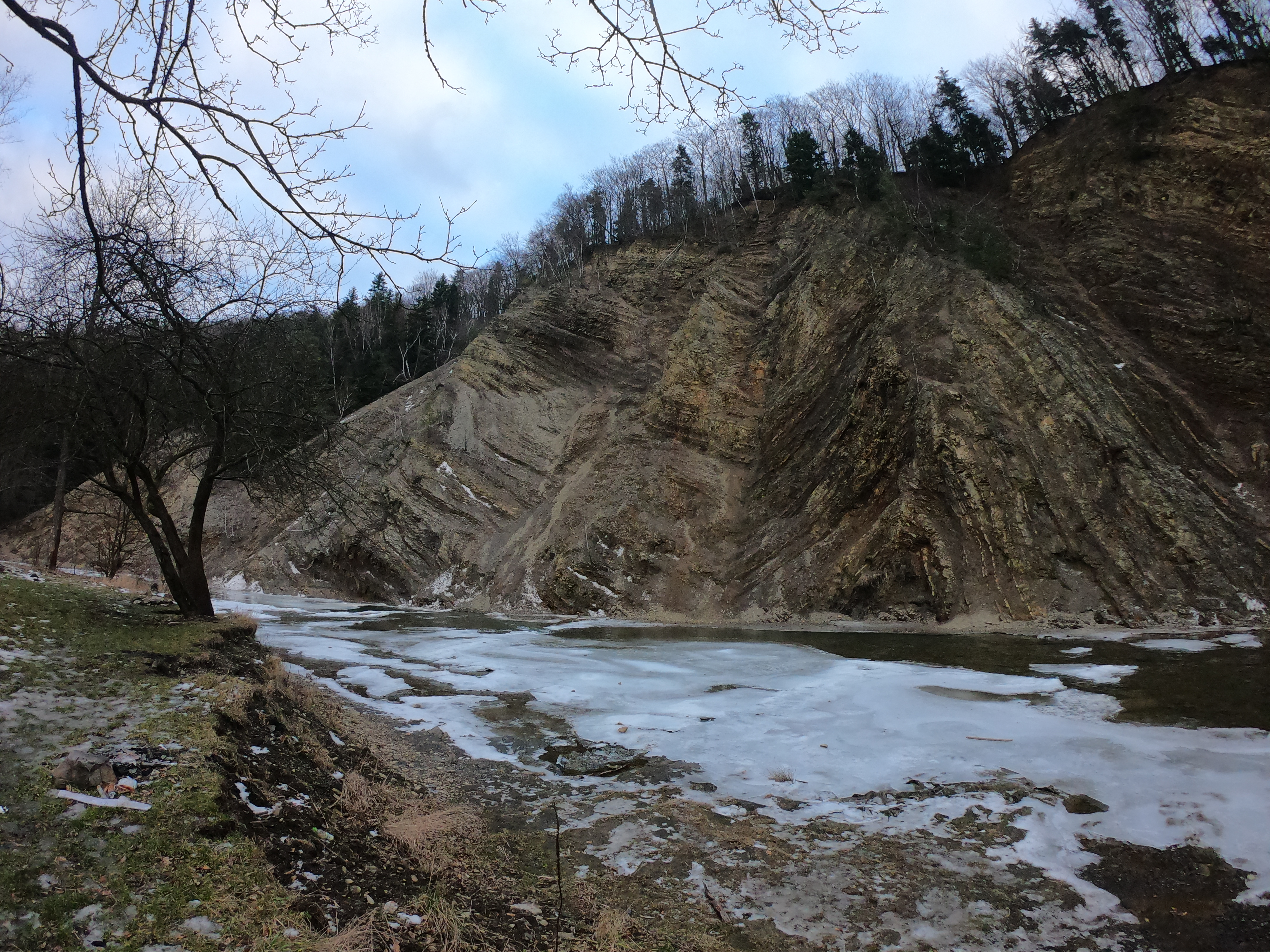
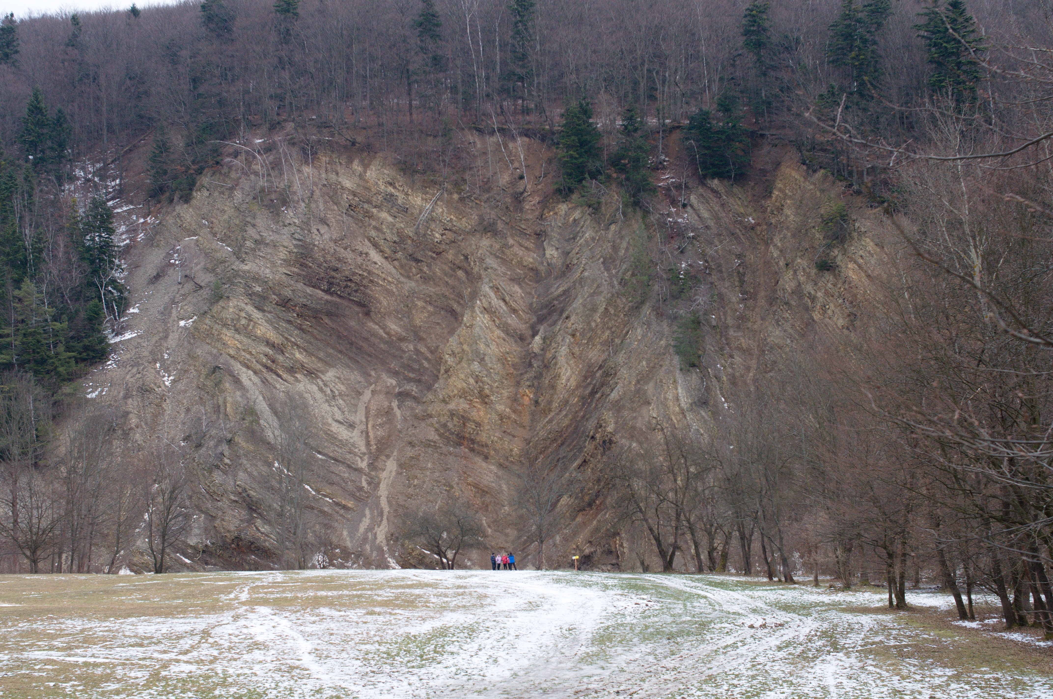
Following the red trail from Rymanów we come to Rudawka Rymanowska village and then the trail turns south to Puławy Dolne. However, it's worth to take some time and go off the trail northwards to be able to see the unique Wisłok River ravine. The river, squeezed very tightly between the Szczob and Kiczerka mountains, begins to meander, thereby undercutting the slopes of the mountains, creating, for example, a 40-meter high cliff called the Olza Wall. It is the largest opencast of menilite shale in the Carpathians: sandstones, shales, marls. The wall was cut by nature in the slopes of the Spalony Horbek mountain (546 m above sea level), which is the northernmost elevation of the Bukowica Range. Strongly deformed layers create amazing shapes. You can see sharp V-shaped bends, i.e. chevron folds, from which the rock layers extend sideways with straight wings. There are also drawn folds resulting from the shifting of rock shoals. Organic and mechanical hieroglyphs and fish prints can be found here. On the other side of Wisłok River there is a board dedicated to the Pope - John Paul II, who as a priest and bishop visited these beautiful sites.
In winter, the water seeping from the rugged walls freezes to form amazing icefall.
